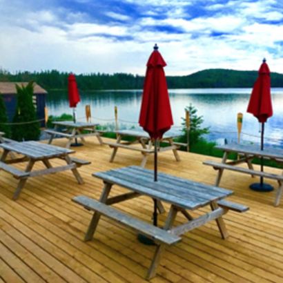
Voyageur Outfitting and the Algonquin Cottage Outpost are located at Algonquin Park Access #1, Kawawaymog Lake. We are accessible year round via gravel road in the summer and snow road in the winter.The GPS co-ordinates for the Outfitter are: 45°55'20.2"N 79°11'05.4"W and for the Cottage Outpost: 45°54'54.9"N 79°11'10.9"W.
Toronto Driving Instructions
From Toronto:
Distance is 302km or approximately 3 1⁄2 hours driving.
• Take highway 401 (east or west) to highway 400.
• Go north on highway 400 towards Barrie.
• At Barrie, follow signs for highway 11 north to North Bay. Continue on highway 11 north past Huntsville to the town of
South River.
• Take exit #282, Boundary/ Mountain View Rd. Continue east for 2.5 km towards South River.
• At the end of Mountain View Rd, turn left onto Highway 124 and continue north for 2.5km.
At South River:
• Turn right on Ottawa Avenue.
• Follow Ottawa Avenue east out of town past Tom Thomson Park, Swift Canoes and over a bridge to Chemical Rd.
• Once over the bridge, contine straight on Chemical Rd. for approximately 25-30 minutes (20 km).
• Continue straight through any intersections until you see the brown Algonquin Park signs for Access Point #1.
• At the end of the road, brown Algonquin Park signs will indicate where the Access Point is located. We are located in the same parking lot.
To continue on to the Algonquin Cottage Outpost:
• Right before reaching the Access Point parking lot, make a right turn down the road.
• You will drive about 1 km up and back down a large hill. At the bottom of this hill a lakeside road will join the
main cottage road (on your left).
• Take the first driveway on your left past this lakeside road. Look for a grey sign with “Nahma, Magnetawan, Nipissing” at
the end of our driveway.
Ottawa Driving Instructions
From Ottawa
Distance is 430km or approximately 4 1⁄2 hours driving
• Take highway 17 west to North Bay.
• Travel south on highway 11 and take exit #306 to the town of Trout Creek
• Follow Carr Rd. 1.5 km. south to the town of Trout Creek
At Trout Creek:
• Make a left at the General Store on Main St (going east).
• Follow this road east out of town. At the top of the hill, turn right onto Forestry Rd.
• Stay on Forestry Rd. for 25 minutes (18km).
• Continue driving past Wendigo Lake/Project Dare. The road will end with a T junction and a stop sign.
• Turn left onto Chemical Rd. Continue for 5 minutes (4 km) You will continue straight to the Algonquin Park Access Point # 1 parking lot.
• At the end of the road, brown Algonquin Park signs will indicate where the Access Point is located. We are located in the same parking lot.
To continue to the Alognquin Cottage Outpost:
• Right before reaching the Access Point parking lot, make a right turn down the road.
• You will drive about 1 km up and back down a large hill. At the bottom of this hill a lakeside road will join the
main cottage road (on your left).
• Take the first driveway on your left past this lakeside road. Look for a grey sign with “Nahma, Magnetawan, Nipissing” at
the end of our driveway.